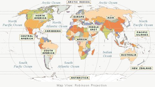
Description: World atlas image showing The United Kingdom up at the top where it says Europe, and The Caribbean down at the bottom below The United States
Image copyright: http://www.infoplease.com/atlas/
The first kind of map under discussion is the topographic map. The topographic map is used to show elements of the landscape, such as, lakes, mountains, cities, and forests (Moline & Drew, 2010). They also use visual representations such as contour lines and elements such as color changes to note things such as changes in elevation and manmade versus natural features (Zahradnik, 2011). These can be helpful for planning a vacation or a hike, and are often used by people who need to know specific features of an area for their work (Zahradnik, 2011). When watching news about the recent Wallow Fire in Arizona it was possible to bring up topographic maps of the White Mountains to see what areas had burned, and the communities, mountains, lakes, and other wilderness areas that had burned each day (Incident Information Systems, 2011).
The second kind of map to learn about today is the physical map. A physical map may show many of the same features as a topographic map, but with less detail about things such as elevations. While they may show mountains, they will lack the contour lines and detail present in a topographic map (Graphic Maps, 2011). Physical maps often show boundaries between cities, states, and countries and roads or other features to help you get from one place to another, or to learn about different places (Graphic Maps, 2011). These are often, but not always, the type of map that we see on the wall of a classroom just like ours. My family uses a physical map when we go on a trip to make sure we know what roads to take to get to our destination.
The final kind of map covered in this discussion is the political map. A political map is used primarily to show the “governmental boundaries of countries, states, and counties, the location of major cities, and they usually include significant bodies of water (Graphic Maps, 2011, p1.)”. While in some ways they are similar to physical maps, they lack the details about landscape features or points of interest. In addition, they are often much more brightly colored to show each different territory (Graphic Maps, 2011). Like the physical map I have seen these displayed in classrooms to learn basic geography. They are very helpful for learning about how different places belong to the same government. Did you know that the United Kingdom has territories all over the world, like the Turks and Caicos Islands located all the way down by Cuba?
This discussion provided a very brief explanation of three types of maps, topographic, physical, and political. While these are all very interesting and serve many different purposes it is important to remember that there are many other kinds of maps as well. Many of them are much simpler in form than the three previously discussed, such as maps of your school or classroom, or maps that show what is happening in the same place at different times of the day (Moline & Drew, 2010). Maps are very interesting and it can be very fun to explore them, or to use them to help you explore different places, even if you can’t get to those places in real life.
References
Info Please (2011). Map: Caribbean. Retrieved from http://www.infoplease.com/atlas/caribbean.html
Graphic Maps (2011). Worldatlas. Retrieved from
http://www.worldatlas.com/aatlas/world.htm
Incident Information Systems (2011). InciWeb. Retrieved from http://inciweb.org/incident/2262/
Moline, S. & Drew, D. (2010). Visual Literacy K-8. Retrieved from http://k-8visual.info/maps.html
Zahradnik, F. (2011). Topographic Maps. Retrieved from http://gps.about.com/od/glossary/g/topographic-map.htm
