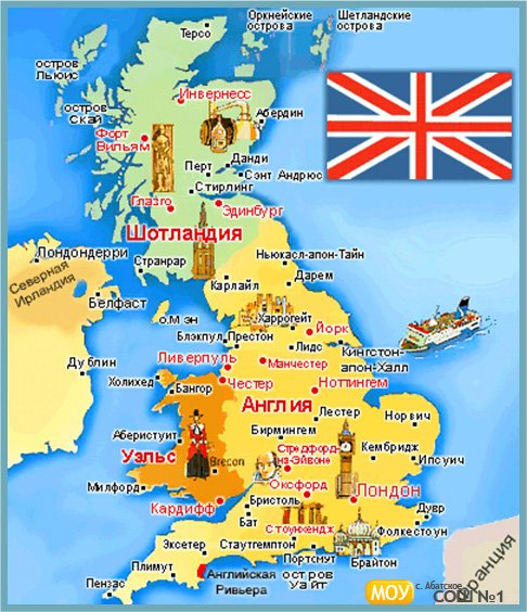
Great Britain lies to the northwest of Continental Europe and east of Ireland. It is separated from the continent by the North Sea and by the English Channel, which narrows to 34 kilometres (21 mi) at the Straits of Dover. It stretches over about ten degrees of latitude on its longer, north-south axis, and occupies an area of 209,331 km2 (80,823 sq mi), excluding all the smaller surrounding islands of the archipelago.The North Channel, Irish Sea, St George's Channel and Celtic Sea separate the island from the island of Ireland to its west. The island is physically connected with continental Europe via the Channel Tunnel, the longest undersea rail tunnel in the world which was completed in 1993. Geographically, the island is marked by low, rolling countryside in the east and south, while hills and mountains predominate in the western and northern regions. It is surrounded by over 1,000 smaller islands and islets. The greatest distance between two points is 968 km / 601.5 miles (between Land's End, Cornwall and John O'Groats, Caithness), or 1,349 km / 838 miles using the national road network.
The English Channel is thought to have been created between 450,000 and 180,000 years ago by two catastrophic glacial lake outburst floods caused by the breaching of the Weald-Artois Anticline, a ridge which held back a large proglacial lake, now submerged under the North Sea.Around 10,000 years ago, during the Devensian glaciation with its lower sea level, Great Britain was not an island, but an upland region of northwestern Europe, lying partially underneath the Eurasian ice sheet. The sea level was about 120 metres (390 ft) lower than today, and the bed of the North Sea was dry and acted as a land bridge to Europe, now known as Doggerland. It is generally thought that as sea levels gradually rose after the end of the last glacial period of the current ice age, Doggerland became submerged beneath the North Sea, cutting off what was previously the British peninsula from the European mainland by around 6500 BC. |

